When you look at the majestic peaks of the Cascade Range stretching from British Columbia down to Northern California, you might wonder if these mountains have finished their grand performance or if the show is still going on. The answer might surprise you. Yes, the Cascade Range is still actively rising, shifting, and forming as part of ongoing geological processes. These mountains represent a dynamic landscape that continues to evolve right beneath our feet.
The Cascade Range includes both the non-volcanic North Cascades and the impressive volcanoes of the High Cascades, all part of the Pacific Ring of Fire. This mountain chain formed through the collision of tectonic plates, with the oceanic plate diving beneath the continental plate in a process called subduction. Geologists have discovered that the North Cascades actually consist of different terranes – chunks of crust that formed elsewhere in the Pacific Ocean before being “glued” to the continent thousands of miles from their origin.
Get a discount of 15% to 70% on accommodation near Iron Goat Trail! Look for deals here:
Iron Goat Trail Hotels, Apartments, B&Bs
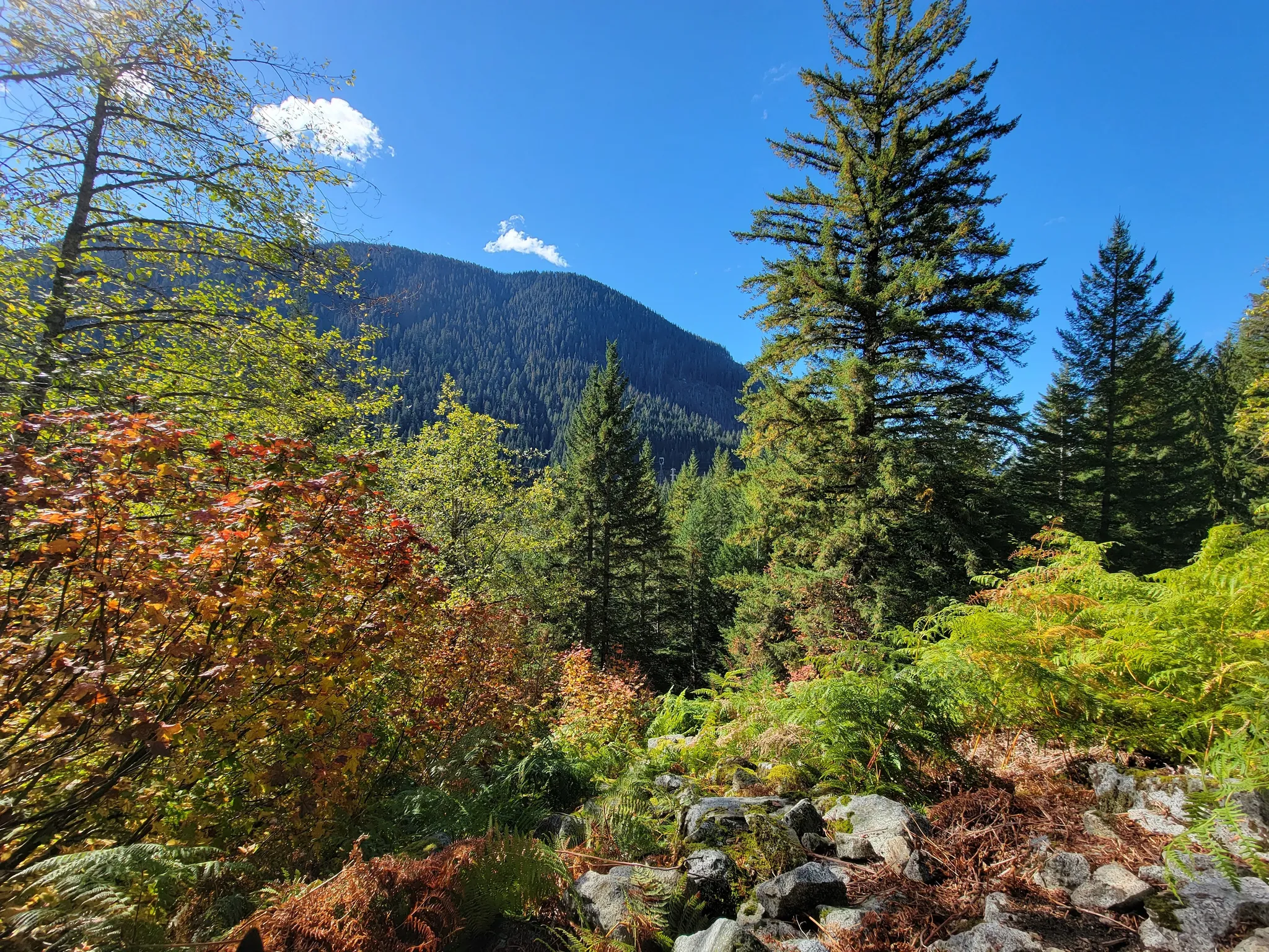
Hikers exploring trails like the historic Iron Goat Trail in Washington state are walking on ground that’s still part of an active geological story. This popular pathway, which follows an abandoned Great Northern Railway route through the Cascades, offers visitors a chance to experience both human history and natural forces at work. As travelers wind their way through tunnels and past avalanche shelters, they’re witnessing a landscape that continues to reach skyward through the same powerful forces that have shaped our planet for billions of years.
Geological Activity and Growth
The Cascade Range remains one of North America’s most geologically active mountain chains. This dynamic region continues to change through ongoing tectonic forces, volcanic eruptions, and the gradual buildup of volcanic materials.
Plate Tectonics and the Cascadia Subduction Zone
The growth of the Cascade Mountains is primarily driven by the Cascadia Subduction Zone, where the Juan de Fuca oceanic plate dives beneath the North American continental plate. This ongoing process has been shaping the range for about 37 million years.
When these plates interact, they generate magma that rises through the crust. This activity is why the Cascades are still rising today. The subduction creates tremendous pressure and heat, forcing the continental crust to bulge upward.
Geologists measure this uplift at rates of several millimeters per year in some areas. While this might seem small, over geologic time it results in significant mountain building.
The North Cascades section shows evidence of recent uplift through elevated river terraces and actively incising streams that create steep valleys.
Recent Eruptions and Their Contributions
Volcanic eruptions continue to add material to the Cascade Range. The most famous recent example is the 1980 eruption of Mount St. Helens, which dramatically altered the landscape.
This explosive event removed 1,300 feet from the mountain’s summit but also began a new growth phase. A lava dome started forming in the crater shortly after the eruption, adding new material to the mountain.
Other active volcanoes in the range include Mount Rainier, Mount Baker, and Mount Hood. Each has shown signs of activity in recent centuries. Mount Rainier had small eruptions in the 1800s, while Mount Baker displayed increased thermal activity in the 1970s.
Recent research has revealed giant magma reservoirs beneath dormant volcanoes in the Cascades. Scientists from the U.S. Geological Survey found these previously unknown persistent magma chambers using advanced seismic monitoring technology.
Volcanic Rocks and Soil Enrichment
The volcanic activity in the Cascades creates distinctive rocks and incredibly fertile soils. When volcanoes erupt, they release minerals that eventually break down into nutrient-rich soil.
Volcanic ash contains high levels of phosphorus, potassium, and trace minerals. These nutrients help support the lush forests that blanket much of the Cascade Range.
The types of rocks found in the Cascades include:
- Andesite (most common)
- Basalt
- Pumice
- Obsidian
These volcanic materials continually weather and erode, creating new landforms. River valleys like the Columbia River Gorge cut through the volcanic layers, exposing the region’s geological history.
Hikers on the Iron Goat Trail in Washington can see this geological story firsthand. The trail follows the old Great Northern Railway route through the Cascades, where volcanic soil and rocks are visible in the surrounding slopes that continue to slowly rise year after year.
Ecological Significance and Climate Impacts
The Cascade Range serves as a critical ecological boundary that influences climate patterns, supports diverse ecosystems, and maintains vital water resources for the Pacific Northwest. These mountains create distinct environmental zones that respond differently to geological and climate forces.
Flora and Fauna of Cascade Ranges
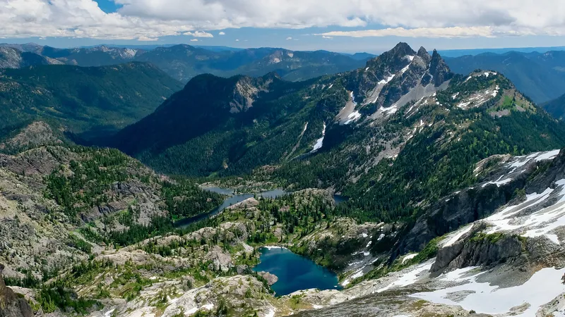
The Cascade Range hosts incredibly diverse ecosystems that change dramatically with elevation. Lush Coniferous Forests dominate lower elevations, with Douglas fir, western hemlock, and cedar trees creating dense canopies that support black bears, elk, and countless bird species.
As elevation increases, the landscape transforms into subalpine meadows filled with vibrant wildflowers during brief summer blooms. These areas provide crucial habitats for marmots, pikas, and mountain goats.
The highest elevations feature Alpine Tundra ecosystems where only the hardiest plants survive. North Cascades National Park preserves some of the most pristine examples of these diverse ecological zones.
Climate change is altering these habitats rapidly. Rising temperatures have caused plant communities to shift upslope, creating competition for alpine species with nowhere else to migrate.
Climatic Factors Affecting the Cascade Growth
The Cascade Range creates a dramatic Temperature Gradient between its western and eastern slopes. Western slopes receive abundant Precipitation from Pacific moisture, while eastern areas experience rain shadow effects.
This moisture difference directly impacts mountain-building processes. Heavier rainfall on western slopes increases erosion rates, which can counteract tectonic uplift in certain areas.
Climate Change has intensified these patterns, bringing more winter rain instead of snow to the Cascades. Washington State has experienced nearly 2°F warming since the early 20th century, altering precipitation patterns that shape the mountains.
Near Glacier Peak, changing freeze-thaw cycles have accelerated weathering processes on exposed rock faces. These shifts modify how the mountains erode and grow over time.
Water Systems: Glaciers, Aquifers, and Rivers
The Cascade Range serves as the Pacific Northwest’s water tower. Glaciers store winter precipitation as ice, slowly releasing meltwater during summer months when rainfall decreases.
These mountain glaciers have shrunk dramatically since the 1900s. The South Cascade Glacier in Washington shows substantial retreat in photos from 1928 to 2003, revealing how rising temperatures threaten these water reservoirs.
Underground Aquifers beneath Cascade Volcanoes store vast quantities of water. Volcanic Aquifers form unique water-holding systems with high porosity in lava tubes and fractured basalt.
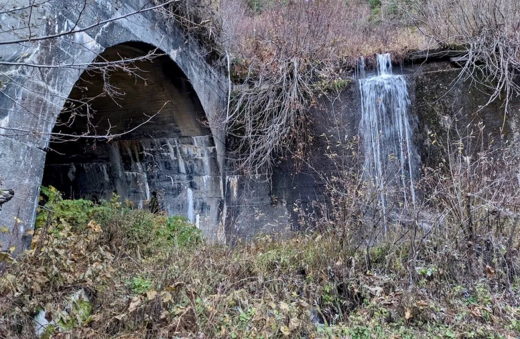
Rivers like the McKenzie flow from these mountains, providing drinking water and hydroelectric power. However, increasingly severe wildfires threaten these watersheds. Visitors to the historic Iron Goat Trail can witness firsthand how water systems have shaped these mountains through dramatic valleys and waterfalls.
Get a discount of 15% to 70% on accommodation near Iron Goat Trail! Look for deals here:
Iron Goat Trail Hotels, Apartments, B&Bs
Iron Goat Trail Hiking Guide: Exploring Washington’s Scenic Railway Path
Iron Goat Trail History: Exploring the Legacy of the Great Northern Railway
Things to Do Near Skykomish, Washington
