The beautiful Cascade Range that stretches from Northern California to British Columbia hides a violent secret beneath its snow-capped peaks. This mountain chain isn’t just a scenic wonder – it sits on one of the world’s most complex tectonic regions. The Cascade Range experiences frequent earthquakes because it’s located along the Cascadia subduction zone, where the Juan de Fuca plate is diving beneath the North American plate, creating significant seismic activity and forming the volcanic mountains we see today.
Many visitors to the Pacific Northwest admire the majestic volcanoes like Mount Rainier without realizing they’re standing in one of North America’s most seismically active regions. Scientists have found evidence of over 40 major earthquakes along the Cascadia subduction zone in the last 10,000 years, with at least 19 massive magnitude 9 events that ruptured the entire length of the zone. These powerful quakes occur roughly every 300-500 years, making this seemingly peaceful mountain range anything but quiet.
Get a discount of 15% to 70% on accommodation near Iron Goat Trail! Look for deals here:
Iron Goat Trail Hotels, Apartments, B&Bs
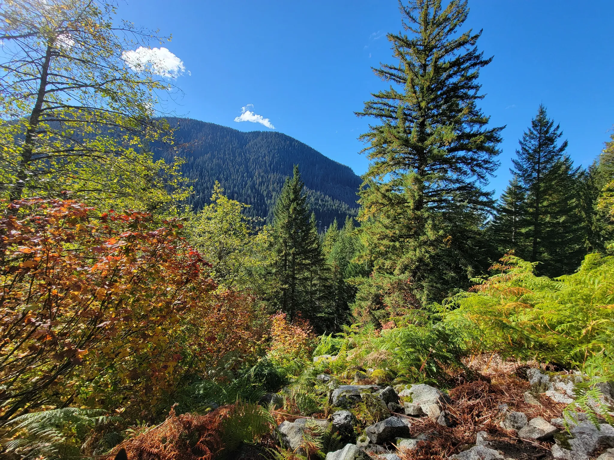
For hikers exploring trails like the Iron Goat in Washington, the gentle slopes and lush forests reveal little of the powerful forces at work below. Yet these pathways wind through landscapes shaped by the same geological drama that continues today, offering a rare chance to walk through living history where the earth’s power is constantly reshaping one of America’s most beloved mountain ranges.
Geological Dynamics of the Cascade Range
The Cascade Range is shaped by powerful forces beneath the Earth’s surface. These geological processes create ideal conditions for both frequent earthquakes and volcanic eruptions that have shaped this magnificent mountain chain over millions of years.
Cascadia Subduction Zone
The Cascade Range owes its seismic activity primarily to the Cascadia subduction zone, where the Juan de Fuca plate dives beneath the North American plate. This subduction process creates tremendous pressure and friction, resulting in different types of earthquakes.
Deep earthquakes are common in this region, with notable examples being the 1949 Olympia (M 7.1) and 1965 Seattle-Tacoma (M 6.5) earthquakes. These occurred within the subduction zone and caused significant damage.
Scientists study seismicity patterns along the Cascadia margin using various methods. One interesting approach involves examining turbidites—underwater landslide deposits that can indicate past major earthquakes.
Strike-slip faults also contribute to earthquake activity in certain areas of the range, adding complexity to the region’s seismic profile.
Volcanic Activity and Its Impact
The Cascade Range hosts numerous active volcanoes formed by the same subduction process. As the Juan de Fuca plate descends, it melts, creating magma that rises to form the impressive chain of volcanoes.
Mount St. Helens provides a dramatic example of this volcanic potential, with its catastrophic 1980 eruption. Recent research has discovered persistent magma chambers beneath several dormant volcanoes in the range, indicating they could potentially become active again.
Mount Rainier, another significant peak, features an active hydrothermal system and contains 25 major glaciers—more snow and ice than all other Cascade volcanoes combined! This combination of volcanic heat and ice creates the potential for dangerous lahars (volcanic mudflows).
Volcanic ash from past eruptions has created fertile soil throughout the region, including near the scenic Iron Goat Trail in Washington, where hikers can witness the geological legacy of these powerful forces while enjoying breathtaking mountain views.
Human Impact and Preparedness
Living along the Cascade Range means dealing with earthquake risks that affect millions of people from Northern California to Vancouver Island. Communities must balance the region’s natural beauty with the realities of disaster planning.
Living with Earthquake Risks
Over 10 million people live in the potential impact zone of a major Cascadia earthquake. Portland, Seattle, and Olympia are especially vulnerable due to their proximity to the fault line and their dense urban infrastructure.
Oregon, Washington, and Northern California have developed extensive earthquake preparedness programs for residents. These include creating emergency kits with food and water for at least two weeks.
Tsunami evacuation routes have been established along coastal areas where waves could arrive within 15-30 minutes after a major quake. These bright blue signs are now familiar sights in coastal towns.
The recurrence interval for major Cascadia earthquakes averages 300-500 years, though the probability varies. The last major event occurred in 1700, putting the region in a period of heightened risk.
Forecasting and Monitoring
Scientists track a phenomenon called ETS (Episodic Tremor and Slip) to understand pressure building along the fault line. These slow-motion earthquakes occur roughly every 14 months and may provide clues about larger events.
Advanced monitoring networks across the Puget Sound region and Vancouver Island use seismometers that can detect even tiny movements. This data helps researchers create more accurate hazard maps.
Aftershocks pose additional threats following a major earthquake. Experts predict a large Cascadia event could trigger thousands of aftershocks lasting months or even years.
Public education campaigns help residents recognize early warning signs. The “Drop, Cover, and Hold On” protocol is now taught in schools throughout the region.
Disaster preparedness organizations work with communities to conduct regular drills. These exercises help identify gaps in emergency response systems before a real crisis occurs.
Get a discount of 15% to 70% on accommodation near Iron Goat Trail! Look for deals here:
Iron Goat Trail Hotels, Apartments, B&Bs
Iron Goat Trail Hiking Guide: Exploring Washington’s Scenic Railway Path
Iron Goat Trail History: Exploring the Legacy of the Great Northern Railway
Things to Do Near Skykomish, Washington
